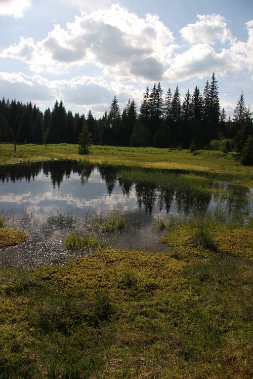
The peat bogs are the most valuable as well as most sensitive biotopes of the Bohemian Forest. Its mystery and old-time stories are indissolubly connected trough this unique world on edge of dry land and water.
For the Bohemian Forest, as for the other Central European forested landscapes, peat lands or mires are relict ecosystems, being more typical for northern tundra and taiga. In the Bohemian Forest, the mire types range from the typical dome-shaped raised bogs that are fully dependant on the rainfall, to the forested or open fens fed mainly by the groundwater. Both types of bogs are often surrounded by waterlogged spruce forest or birch forest on peaty soils. They host rare orchids, such as lesser twayblade (Listera cordata) and coral-root orchid (Corallorhiza trifida). Non-forested sedge mires are usually smaller and can be either natural (located on springs) or secondary (developed as the results of deforestation and traditional land use). They are important for their high biodiversity (both plants and insects).
The largest Central European complex of peat bogs and marshlands covering over 10,000 ha has been designated as the Ramsar site since 1990.
About 70% of mires in the Bohemian Forest have been influenced by past drainage for variously forestry, agriculture and peat extraction. Since 1999, a comprehensive "Mire Restoration Programme" has been implemented in the Šumava National Park, primarily focused on the disturbed hydrology. Selected drained and intact mires are monitored with the aim: i) to characterise the degradation changes induced by the disturbed hydrology; and ii) to evaluate the success of restoration. Water-table fluctuations, hydrochemistry of groundwater, surface-water outflow, amount of precipitation and the vegetation on permanent plots have been monitored.
 Supported by Advance eLTER project number 739558