LTER plot Thermophilous forests includes five regions and sixteen localities in Central Bohemia and Southern Moravia, where ecosystems of thermophilous forests, including adjacent natural treeless vegetation, have been studied for a long time. The monitoring is run jointly by the Institute of Botany of the Czech Academy of Sciences (coordination R. Hédl) and the Silva Tarouca Research Institute for Landscape and Ornamental Gardening (coordination D. Adam).
The main focus is on the plant community, including trees and herbs, which are monitored by using sets of permanent plots, or as continuous forest stands. Data are collected at the level of individuals (plants), plant communities (species composition and biodiversity) and ecosystem (soil, canopy, microclimate and other variables). The backbone of the monitoring system consists of nearly 500 long-term monitoring plots. These are supplemented by several dozens of short-term monitoring plots, and historical plots resurveyed only once after several decades.
The monitored forest stands share similar natural conditions and management history. They cover a wide range of thermophilous forest communities, mainly thermophilous oak-hornbeam forests, various types of oak and ravine forests, occasionally beech forests and the adjacent open habitats (rocky steppes).
The dominant type of management was coppicing in most sites, mainly as coppices-with-standards. The historical management was abandoned during the 19th and early 20th centuries, and the monitored ecosystems were managed with a decreasing intensity in about the past half a century. Some of the localities or their parts are subject of non-intervention regime at present. This has affected the age of the forest stands, which has increased by several times. Today, many stands are 100+ years old.
All monitored localities are parts of conservation areas, often multiple combinations - national nature reserves (NNR), national nature monuments (NNM), nature reserves (NR), national park (NP), protected landscape area (PLA), EU Site of Community Importance (SCI). The main strategy of the nature conservation is the management reduction at most sites. In several cases, however, restoration of the traditional ways of forest management has been introduced in the past years.
The LTER site Thermophylous forests overview of subplots and localities
| Locality (Bohemia) | Týřov | Velká Pleš | Červený kříž | Prostřední vrch | Vysoká stráň | Doutnáč | Tobolský vrch | Za lípou | Kodská stěna |
| Subplot | Křivoklátsko | Křivoklátsko | Křivoklátsko | Český kras | Český kras | Český kras | Český kras | Český kras | Český kras |
| Latitude (North) | 49°59'02" | 49°59'23" | 49°59'32" | 49°56'16" | 49°57'49" | 49°57'31" | 49°55'48" | 49°56'32" | 49°56'02" |
| Longitude (East) | 13°47'42" | 13°48'11" | 13°55'53" | 14°10'14" | 14°08'28" | 14°09'14" | 14°05'32" | 14°06'28" | 14°06'52" |
| Altitude (m a.s.l.) | 420 | 347–497 | 420 | 220–383 | 250–435 | 320–433 | 390–467 | 305–376 | 315–380 |
| Area [ha] | --- | 10 | --- | 42 | 56 | 68 | 53 | 23 | 16 |
| Locality (Moravia) | Lipina | Šobes | Popice | Hnanice | Děvín | Milovický les | Hodonínská Dúbrava |
| Subplot | Podyjí | Podyjí | Podyjí | Podyjí | Pálava | Pálava | Dúbrava |
| Latitude (North) | 48°49'22'' | 48°49'34'' | 48°49'33" | 48°48'23" | 48°52'10" | 48°49'43" | 48°52'31" |
| Longitude (East) | 15°57'54'' | 15°58'26'' | 16°00'10" | 15°57'46" | 16°39'02" | 16°42'32" | 17°04'35" |
| Altitude (m a.s.l.) | 268–364 | 368–393 | 312–385 | 290–383 | 255–550 | 170–350 | 160–190 |
| Area [ha] | 5 | 3 | 140 | 162 | 394 | 2151 | 4820 |
Geographic coordinates represent centres of localities.
The Thermophilous forests site consists of the following five areas and sixteen localities:
1. Křivoklátsko Protected Landscape Area
Monitoring of the dynamics of tree communities (including 3D scanning), vegetation including the communities of vascular plants, fungi, saproxylic beetles and soil processes. Data are available from 1976, 1999, 2004 and annually since 2004 (localities Velká Pleš and Týřov), or since 1993 (locality Červený kříž)
- Velká Pleš: 10 ha of continuous forest stand monitoring, 400 microplots (20 x 20 cm) and monitoring of game impact on rocky steppes (pleše = balds).
- Týřov: 400 microplots (20 x 20 cm) in xerothermic treeless habitats and in enclosures.
- Červený kříž: focus on the impact of game on the diversity of plant communities.
2. Český kras Protected Landscape Area
Monitoring of the dynamics of plant communities, soil and tree overstory in five-year intervals, using a network of 190 permanent plots. Microclimatic measurements in part of the plots. Data from 2005, 2009, 2014, 2019. Focus on the tree dynamics at one locality (Doutnáč). Part of the area left for spontaneous development, part subject of the traditional management restoration. Additionally, 57 historical vegetation plots resurveyed after 50 years.
- Karlštejn NNR: three localities Prostřední vrch, Vysoká stráň and Doutnáč; collective area 166 ha.
- Koda NNR: three localities Tobolský vrch, Za lípou and Kodská stěna, collective area 95 ha.
3. Podyjí National Park
Monitoring of the dynamics of several forest ecosystem components, focusing on natural processes and the restoration of traditional management forms. Continuously measured tree stands, yearly monitoring of plant communities, invertebrates, bryophytes, snails, fungi and soil variables by using a network of plots. Data available from 2010 and 2014-onwards. A network of 50 permanent plots with five-year monitoring interval was established in 2018.
- Four localities in the eastern part of the national park: Lipina, Šobes, Popice and Hnanice, collective area 309 ha.
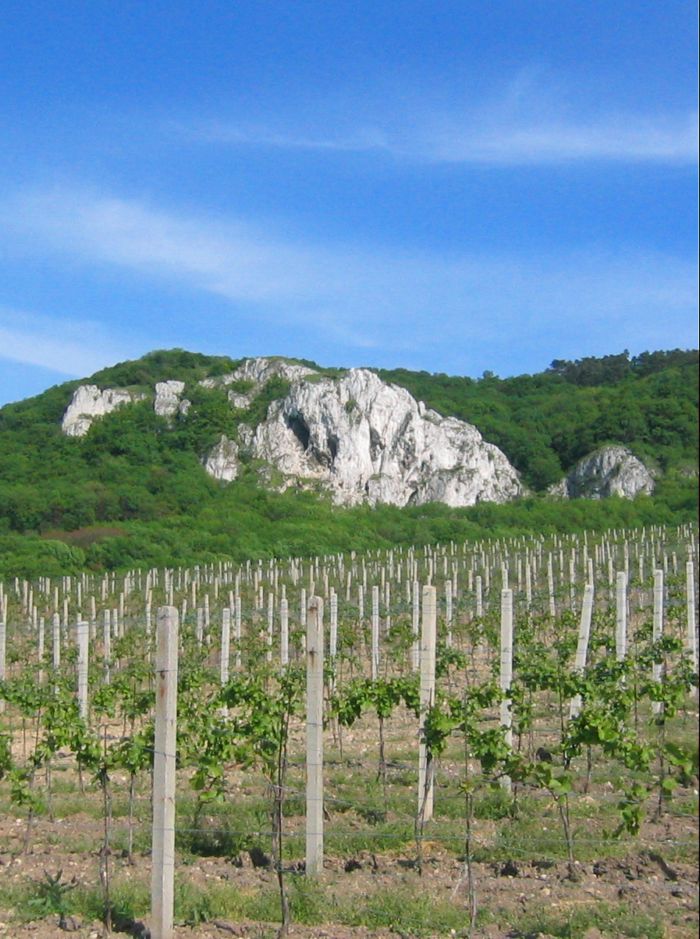
4. Pálava Protected Landscape Area
Monitoring of the dynamics of plant communities, soil and tree overstory in five-year intervals, using a network of 160 monitoring plots. Microclimatic measurements in part of the plots. Monitoring of spider, beetle and ant communities in addition to that. Data available from 2008-onwards. Next to it, about 230 historical vegetation plots resurveyed after 50-60 years, and a detailed research on the management history.
- Děvín NNR: 380 ha, 85 permanent plots and about 180 resurveyed historical plots.
- Milovický les: 2051 ha, 75 permanent plots a 46 resurveyed historical plots.
5. Dúbrava
Monitoring of the dynamics of plant communities, soil and tree overstory in five-year intervals, using a network of 75 monitoring plots. Data from 2011, 2012 and 2017. In addition to that, 56 historical vegetation plots resurveyed after 50 years, covering a larger area. Detailed research on the management history and a paleoecological research covering the entire Holocene.
- Hodonínská Dúbrava: 4820 ha, 75 permanent plots and 56 resurveyed historical plots.
 Supported by Advance eLTER project number 739558
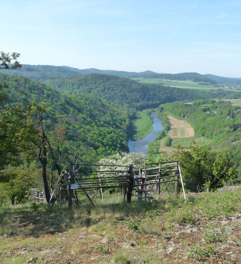